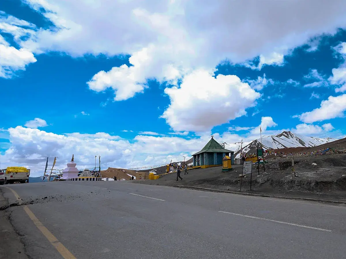
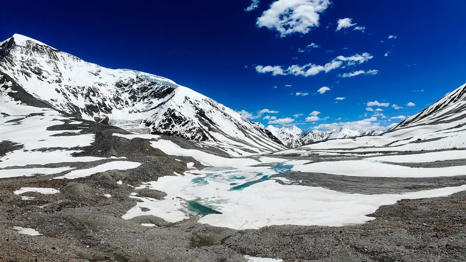
Tanglang La Pass is one of the highest mountain passes in India and the second highest on the Manali–Leh highway. At around 17,480 feet above sea level, it stands tall like a frozen rooftop between Ladakh and Himachal Pradesh. Years ago, this pass was a part of ancient trade routes that connected India to Tibet and Central Asia. Nomads, traders, and monks crossed it with animals and goods.
In more recent times, the Indian army and Border Roads Organisation (BRO) helped build and maintain the road, making it strong enough for modern vehicles. Today, Tanglang La is known as one of the highest motorable roads i ...

 1.jpg)
 4.jpg)

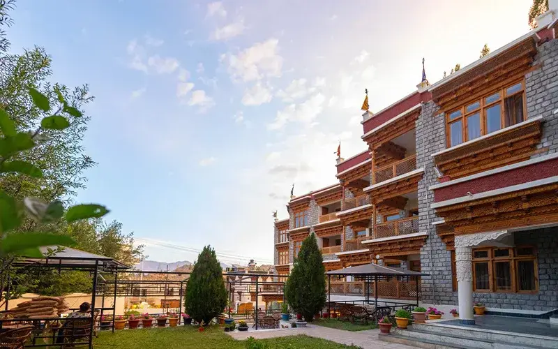
Hotels In Leh Ladakh
Experience peaceful stays amid mountains, lakes, and clear skies.
Packages Of Leh Ladakh
Experience Ladakh’s mountains, lakes and culture with our curated packages.
Places To Visit In Leh Ladakh
Best Places to Visit in Leh Ladakh for an Unforgettable Trip
.webp)
Blogs Leh Ladakh
High-altitude adventures and serene Tibetan-style landscapes
.webp)
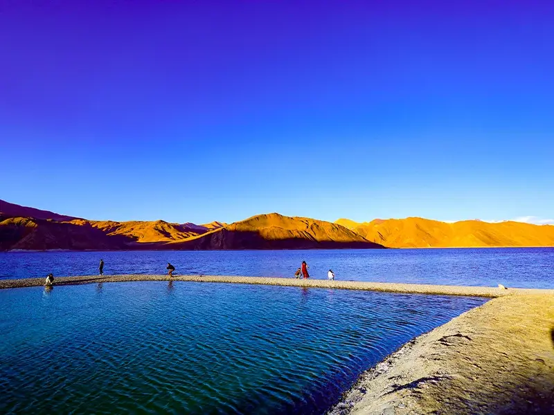
Images Of Leh Ladakh
Explore Ladakh’s raw beauty through real and scenic images.
Hotels In Leh Ladakh
Packages Of Leh Ladakh
Places To Visit In Leh Ladakh
Blogs Leh Ladakh
Images Of Leh Ladakh
🧭 Very High Altitude – Breathe Slowly
Oxygen levels are low at this height, so it’s important to walk slowly and breathe deeply to avoid dizziness or nausea.
🕒 Visit from June to September Only
The road remains snow-free and open for travelers during these months. It’s not safe in other seasons due to snow and landslides.
🧴 Use Sunscreen and Lip Balm
The sun at high altitude is very strong and can easily cause sunburns. Also, the dry air can make your lips crack, so apply balm often.
🚫 Don’t Stay Long
Because of the thin air, it’s not advisable to stay at the top for more than 10 to 15 minutes. Rest, click photos, and descend safely.
💧 Keep Drinking Water
Dehydration can lead to altitude sickness. Keep sipping water even if you don't feel thirsty.
🧢 Wear Sunglasses and a Cap
The glare from snow and direct sunlight can harm your eyes. A cap will help protect your head from direct heat.
📶 No Mobile Network
There is no mobile signal at the top, so make sure you inform someone before your trip and don’t rely on maps.
🧳 Carry Woolens
Even on sunny days, the air at the top is cold. Always wear or carry warm clothes to avoid catching a cold.
🧥 Thermal + Windproof Jacket
At high altitude, even a slight breeze feels very cold. A thermal layer keeps you warm, and a windproof jacket blocks chilly gusts.
👖 Warm Pants
Thick, warm pants or thermal leggings under jeans will keep your legs from freezing in the wind.
🧤 Woolen Gloves & Cap
Fingers and ears lose heat quickly. Gloves keep your hands from numbing, and a woolen cap keeps your head warm.
👟 Grip Shoes
Snow patches and loose gravel can be slippery. Proper shoes with grip help prevent falls and keep your feet dry.
🧢 Sunglasses + Cap
High-altitude sun is harsh. Sunglasses protect your eyes from glare, and a cap shields your head.
🫁 Acclimatize in Leh First
Spend at least 1–2 days in Leh before going to Tanglang La to let your body adjust to the lower oxygen levels.
💊 Carry Doctor-Advised Medicine Like Diamox
Diamox helps your body adjust to high altitude but only take it after consulting your doctor.
💧 Stay Hydrated
The dry air causes your body to lose water quickly. Drink water regularly to keep energy levels up.
😵 Know the Symptoms
Dizziness, headaches, shortness of breath, and nausea could be signs of altitude sickness. If this happens, descend immediately.
🧓 Avoid if You Have Breathing Issues
The air is too thin for those with asthma, heart conditions, or lung problems. It’s better to avoid this place unless cleared by a doctor.
🥟 Momos at Pang Dhaba (40 km away)
These warm dumplings are stuffed with vegetables or meat and served piping hot. Perfect comfort food for the chilly weather.
🍜 Thukpa in Rumtse Village
A spicy noodle soup made with broth, veggies, and sometimes meat. It’s hearty, warm, and energizing after a cold ride.
☕ Butter Tea from Tent Cafés
Traditional pink tea made with yak butter and salt. Locals drink it for warmth and energy. It has a salty, creamy taste.
🍫 Carry Snacks Like Dry Fruits or Chocolate
You won’t find shops at the top. Dry fruits, chocolates, and energy bars give quick energy during the drive.
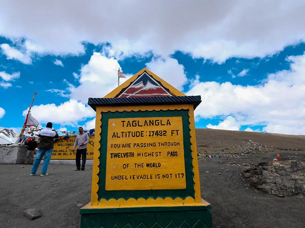
📸 Click a Picture at the Yellow Sign
Stand proudly next to the board that shows your achievement of reaching this high-altitude destination. It's a memory worth saving.
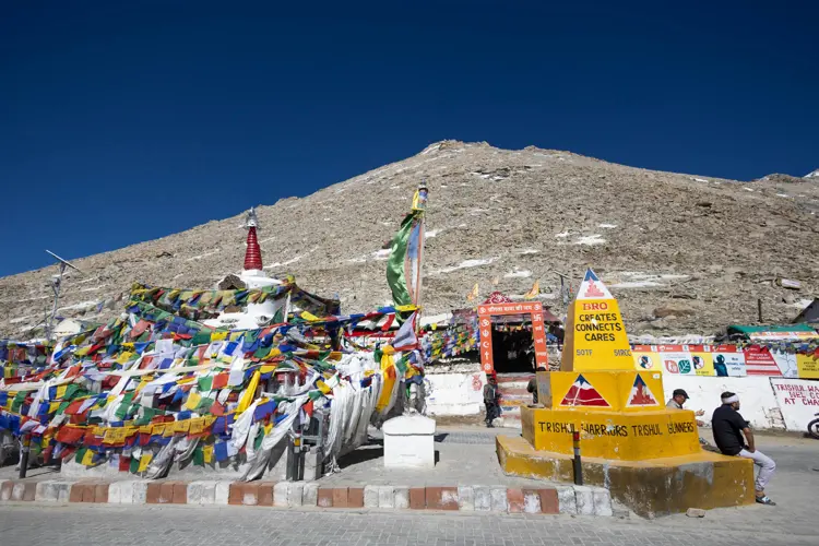
🎏 Tie a Prayer Flag
Carry a flag and tie it with your wish written inside. It’s believed that the wind will carry your prayers far and wide.
🌄 Watch the Mountains All Around
Take a moment to slowly turn around and look in every direction. The views are vast, white, and peaceful.
🚗 Feel the Adventure of the Drive
The road to Tanglang La is full of sharp turns, changing scenery, and breathtaking views. Enjoy every twist and climb.
🧘 Pause for Silence
Just stop, close your eyes, and listen. The cold wind, the quiet around, and the height will calm your mind.
🏘️ Rumtse Village – A small, peaceful village at the base of the pass. Good for rest and warm food.
🏞️ More Plains – A long, flat stretch of road with stunning mountain views. Feels like a different world.
🌉 Gata Loops – A famous series of 21 hairpin bends that climb up the mountains. A must-drive experience.
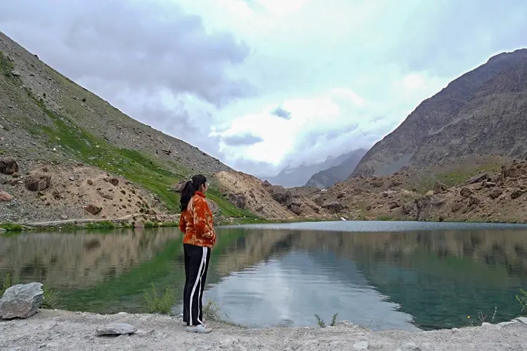
🏞️ Tso Kar Lake – A beautiful saltwater lake nearby, known for birds like cranes and geese. Calm and pretty.
⛺ Sarchu Base Camp – A common night stop for bikers traveling between Leh and Manali. Great for camping under stars.
By taxi, bike, or private vehicle via Leh–Manali Highway
Tanglang La Pass is one of the highest mountain passes in India and the second highest on the Manali–Leh highway. At around 17,480 feet above sea level, it stands tall like a frozen rooftop between Ladakh and Himachal Pradesh. Years ago, this pass was a part of ancient trade routes that connected India to Tibet and Central Asia. Nomads, traders, and monks crossed it with animals and goods.
In more recent times, the Indian army and Border Roads Organisation (BRO) helped build and maintain the road, making it strong enough for modern vehicles. Today, Tanglang La is known as one of the highest motorable roads in the world. It's not just a pass; it’s a thrilling experience for bikers, road trip lovers, and photographers.
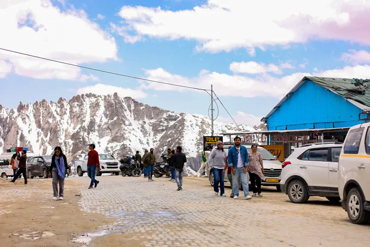
Despite being remote, the road is well maintained and clean. Most people stop here to click photos with the signboard that reads its proud height. The air is thin, the skies are clear, and everything around looks grand and silent. Tanglang La Pass is not a place where people stay, but it’s a moment they always reme
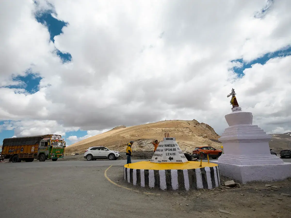
🏔️ Second Highest Pass on Manali–Leh Road
Tanglang La is around 17,480 feet high. The only higher one nearby is Khardung La.
🛣️ One of the Highest Motorable Roads
You can drive or bike to this pass – no trekking needed, but breathing can be tough.
📸 Photo Spot with Signboard
The big yellow sign showing the height is a popular photo stop.
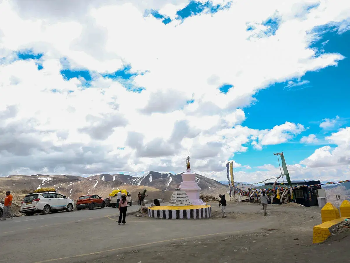
❄️ Snow All Around – Even in Summer
Snow remains near the pass throughout most of the year.
🚫 No Stopping for Long
Due to thin air and freezing wind, most people stop for just 10–15 minutes.
💬 Prayer Flags Flutter at the Top
Locals hang colorful flags here, which flap in the wind and carry good wishes.
🧱 Stone Towers Built by Travelers
Small stone piles can be seen along the road, left by people who made a wish.
1. The Road of Breathlessness and Beauty
A traveler once fainted from excitement — not just because of the height, but also the breathtaking beauty. As he woke up wrapped in blankets, he said, “I saw heaven for a second.” Such is the magic of Tanglang La, where the thin air makes your head dizzy, and the views make your heart happy.
2. A Message in the Wind
A local BRO worker tells the story of a soldier who built a tiny pile of stones here and whispered his wish into the cold wind. That pile still stands today, with many others around it, as travelers come and leave their own wishes. Locals believe the wind here carries your wish to the sky.
The Himalayan Mountains are a majestic mountain range in South Asia, spanning five countries. They boast the world's highest peaks, including Mount Everest. These young, growing mountains feature rugged, snow-capped peaks, deep valleys, and glaciers. The Himalayas influence regional climate, harbor unique biodiversity, and hold cultural and spiritual significance. They attract adventurers, nature lovers, and spiritual seekers from around the world.